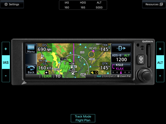
The Garmin GPS Trainer simulates the system user interface and provides the opportunity to explore the features, options, and fundamental operational aspects of the avionics. When used in combination with the GPS Navigator Series Pilot’s Guide, the trainer can be an effective way to improve avionics familiarity and proficiency at a time and location convenient to the user. The Trainer is also a great way to prepare for a flight because a user can load the anticipated flight plan and “chair fly” the avionics portion of the flight before entering the aircraft.
The GPS Trainer includes:
• Simulated multi-touch and drag interface – allows you to interact with the system, graphically edit flight plans, and much more
• Garmin SafeTaxi – allows you to view detailed airport information on the moving map
• High resolution worldwide terrain maps and aviation databases
• High resolution obstacle databases including power line alerting
• Simulated interfaces and data including:
-- ADS-B Traffic with TargetTrend™ Relative Motion
-- FIS-B Weather with animated NEXRAD
-- Airspaces, airways, and Visual Reporting Points
* Note: This app contains simulated data and does not receive data from or interact with real Garmin avionics. This app should not be used for actual navigation purposes.


